No special weather alerts are in effect for the region at this time.
Medicine Hat and Redcliff
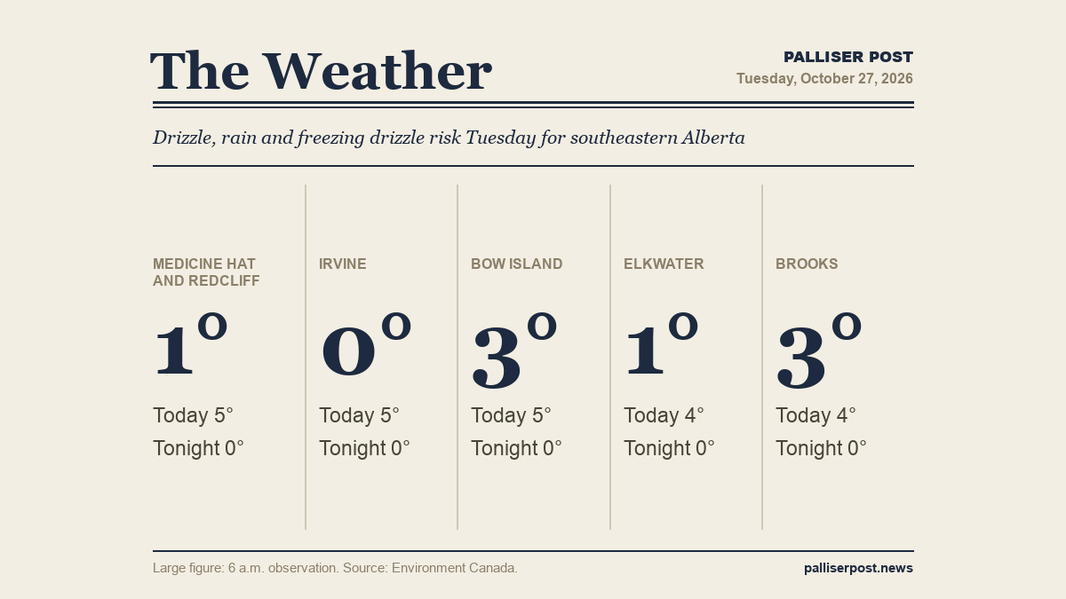
At 6 a.m. at the Medicine Hat airport, skies were cloudy and the temperature was 1.1 C, with calm winds and humidity at 96 per cent. Environment Canada is calling for periods of drizzle or rain Tuesday, with a 30 per cent chance of drizzle early changing to a 60 per cent chance of rain showers near noon. There is a risk of freezing drizzle early this morning. Fog patches will dissipate through the morning. Winds become west 20 km/h gusting to 40 this afternoon. High of plus 5. UV index 1 or low. Tuesday night brings periods of rain or snow, with a west wind 20 km/h gusting to 40 becoming light by evening. Low of zero.
Irvine
At 6 a.m. in Irvine, the temperature was 0.2 C with calm winds and humidity at 100 per cent. Environment Canada calls for drizzle or rain through Tuesday, with the chance of drizzle early — 30 per cent — climbing to a 60 per cent chance of rain showers around midday. Freezing drizzle is possible early this morning, and fog patches should clear through the morning hours. A west wind of 20 km/h gusting to 40 develops this afternoon. High of plus 5. UV index 1 or low. Overnight, rain or snow is likely, with a west wind 20 km/h gusting to 40 easing by evening. Low of zero.
Bow Island
At 6 a.m. at the Bow Island Climate station, it was 3.3 C with a south-southeast wind of 17 km/h and humidity at 93 per cent, with pressure falling. Tuesday's forecast from Environment Canada calls for periods of drizzle or rain — a 30 per cent chance of drizzle early rising to a 60 per cent chance of rain showers near noon — along with a risk of freezing drizzle this morning and fog patches clearing later in the morning. Winds shift to west at 20 km/h gusting to 40 this afternoon. High of plus 5. UV index 1 or low. Rain or snow is expected overnight on a west wind 20 km/h gusting to 40, becoming light by evening. Low of zero.
Elkwater and Cypress Hills
At 6 a.m. at Lodge Creek, it was 1.3 C with a southeast wind of 15 km/h and humidity at 100 per cent. Environment Canada is forecasting a wetter Tuesday for the Cypress Hills, with a 60 per cent chance of rain showers or flurries early this morning giving way to periods of rain mixed with snow through the rest of the day. An east wind of 20 km/h becomes light this morning before shifting to west 20 km/h gusting to 40 near noon. High of plus 4. Tuesday night, mixed rain and snow continues before tapering off overnight, then cloudy with a 30 per cent chance of flurries. West wind 20 km/h gusting to 40 eases by evening. Low of zero.
Brooks
At 6 a.m. in Brooks, the temperature was 3.1 C with a south-southeast wind of 2 km/h and humidity at 89 per cent, with pressure falling. Environment Canada calls for cloudy skies Tuesday with a 60 per cent chance of showers arriving late in the afternoon — later than most of the region. Fog patches will clear through the morning. High of plus 4. UV index 1 or low. Tuesday night, a 60 per cent chance of rain showers or flurries is expected, changing to a 30 per cent chance of flurries after midnight. Low of zero.
Outlook
Wednesday brings a mix of sun and cloud across most of the region with a 30 per cent chance of flurries in the morning and a northwest wind developing at 20 km/h gusting to 40 in many communities; highs range from plus 1 in Brooks to plus 4 in Elkwater and Cypress Hills. Wednesday night will be cloudy with a 60 per cent chance of flurries in Medicine Hat, Redcliff, Irvine and Bow Island, and lows ranging from minus 4 to minus 6. Thursday sees a mix of sun and cloud or sunny skies with highs of zero to plus 1, followed by clear and cold Thursday nights with lows falling to minus 8 in Elkwater and as low as minus 11 in Brooks.
Forecasts and observations from Environment Canada.