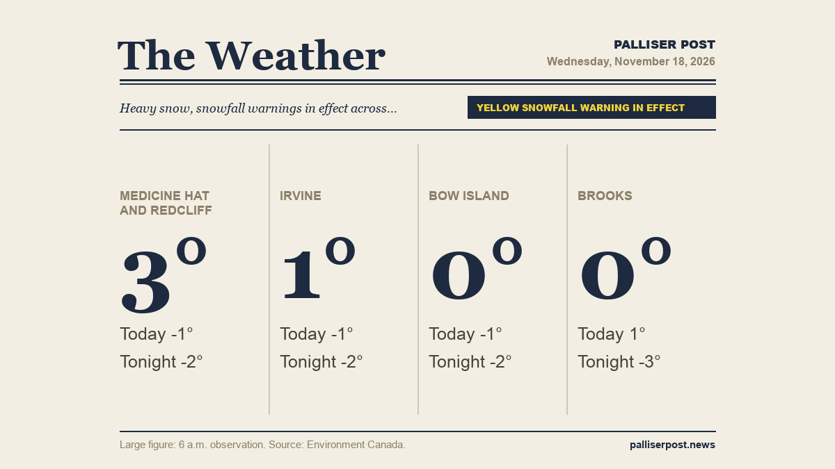
Heavy snow is pushing across southeastern Alberta on Wednesday, with Environment Canada forecasting snowfall amounts of five to 10 cm for much of the region before conditions ease later in the day. North winds gusting to 40 km/h will accompany the snow, and temperatures will hover near the freezing mark before dropping slightly this afternoon and overnight. A risk of freezing drizzle is expected overnight into Thursday morning in several areas.

Environment Canada has issued a Yellow Warning — Snowfall for Medicine Hat, Redcliff, Irvine, Bow Island and Brooks, cautioning that adverse conditions are expected and safety precautions should be taken.

Medicine Hat and Redcliff

At 6 a.m. at the Medicine Hat airport, it was 2.9 C with light snow falling, a north-northeast wind of 23 km/h gusting to 36 km/h and visibility of 8 km. Environment Canada is forecasting rain or snow changing to snow at times heavy Wednesday morning, with a snowfall amount of 10 cm. A north wind of 20 km/h gusting to 40 is expected, with the temperature falling to minus 1 this afternoon. Overnight, snow will end near midnight, then cloudy with a 30 per cent chance of flurries, a risk of freezing drizzle and fog patches developing. Low of minus 2, wind chill near minus 7. A Yellow Warning — Snowfall is in effect for Medicine Hat and Redcliff.

Irvine

At 6 a.m. at Irvine, the temperature was 1.1 C with a north-northeast wind of 15 km/h and humidity at 81 per cent. Snow at times heavy is forecast through Wednesday morning, with 10 cm of snowfall expected and a north wind of 20 km/h gusting to 40 km/h. The temperature falls to minus 1 this afternoon. Snow winds down near midnight, giving way to a 30 per cent chance of flurries overnight, along with a risk of freezing drizzle and fog patches. The overnight low is minus 2 with a wind chill near minus 7. A Yellow Warning — Snowfall is in effect for Irvine.

Bow Island

At 6 a.m. at the Bow Island Climate station, the temperature was 0.0 C with a wind chill of minus 4, a north-northwest wind of 13 km/h and humidity at 98 per cent. Wednesday brings rain or snow transitioning to snow at times heavy, with 10 cm of accumulation forecast. A north wind of 20 km/h gusting to 40 km/h is expected, and the temperature eases to minus 1 this afternoon. Overnight, snow tapers off near midnight with a 30 per cent chance of flurries remaining, a risk of freezing drizzle and fog patches forming. Low minus 2, wind chill near minus 7. A Yellow Warning — Snowfall is in effect for Bow Island.

Brooks

At 6 a.m. at Brooks, the temperature was 0.3 C with a north-northeast wind of 25 km/h gusting to 34 km/h and humidity at 97 per cent. Snow at times heavy is forecast to change to light snow Wednesday afternoon, with an accumulation of five to 10 cm. A north wind of 20 km/h gusting to 40 km/h will become light by afternoon, and the temperature holds near plus 1 through the day. Wednesday night brings a 30 per cent chance of flurries, a risk of freezing drizzle and late-evening fog patches. The low is minus 3 with a wind chill near minus 7. A Yellow Warning — Snowfall is in effect for Brooks.

Outlook

Thursday will be mainly cloudy across the region with a 30 per cent chance of flurries in the morning, light snow developing in the afternoon and a risk of freezing drizzle lingering into the morning hours. Highs reach plus 1, though a wind chill of around minus 6 to minus 7 will be felt in the morning, and the UV index is 1 or low. Thursday night stays cloudy with a 30 to 40 per cent chance of flurries and lows of minus 3. Friday brings continued cloud and a 30 per cent chance of flurries for most of the region, with highs of minus 3 and lows dipping to minus 8 or minus 9 overnight.

Forecasts and observations from Environment Canada.

Share this article
The link has been copied!