A multi-day winter storm is taking shape across southeastern Alberta, according to Environment Canada. Rain is expected to begin near noon Tuesday before changing to heavy snow Tuesday night and continuing through Wednesday, with total accumulations of 10 to 20 cm possible in some areas.

Environment Canada has issued a Yellow Warning — Snowfall for Medicine Hat, Redcliff, Irvine, Bow Island and Brooks. A Special Weather Statement is in effect for Elkwater.

Medicine Hat and Redcliff

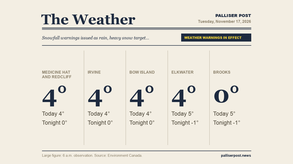
At 6 a.m. at the Medicine Hat airport, it was 3.6 C under cloudy skies with a north-northeast wind of 5 km/h and humidity at 79 per cent. Environment Canada forecasts rain beginning near noon, mixing with snow late Tuesday afternoon, with a high of plus 4. A northeast wind of 20 km/h develops Tuesday afternoon. Tuesday night, rain or snow changes to heavy snow late in the evening; snowfall amount 10 cm, wind northeast 20 km/h gusting to 40, low of zero. A Yellow Warning — Snowfall is in effect for Medicine Hat and Redcliff.

Irvine

At 6 a.m. at Irvine, the temperature was 3.7 C with humidity at 80 per cent and a light north-northeast wind of 3 km/h. Environment Canada calls for cloudy skies with rain developing near noon and mixing with snow late Tuesday afternoon, reaching a high of plus 4. A northeast wind of 20 km/h moves in during the afternoon. Overnight, snow at times heavy is expected with 10 cm of snowfall, northeast wind 20 km/h gusting to 40, and a low of zero. A Yellow Warning — Snowfall is in effect for Irvine.

Bow Island

At 6 a.m. at the Bow Island Climate station, it was 3.6 C with humidity at 64 per cent and a north-northwest wind of 9 km/h. The forecast from Environment Canada calls for rain to begin near noon and mix with snow late Tuesday afternoon under cloudy skies, with a high of plus 4. A northeast wind of 20 km/h builds Tuesday afternoon. Tuesday night brings heavy snow at times, 10 cm of accumulation, northeast wind 20 km/h gusting to 40, and a low of zero. A Yellow Warning — Snowfall is in effect for Bow Island.

Elkwater and Cypress Hills

At 6 a.m. at Lodge Creek, the temperature was 4.3 C with a south wind of 3 km/h and humidity at 73 per cent. Environment Canada expects rain or snow to begin Tuesday morning, with a local rainfall amount of 5 mm and a high of plus 5. A northeast wind of 20 km/h gusting to 40 arrives Tuesday afternoon. Overnight, rain or snow changes to snow late in the evening with local snowfall amounts of 5 to 10 cm; wind northeast 20 km/h gusting to 40 before going light near midnight, low minus 1. A Special Weather Statement is in effect for Elkwater.

Brooks

At 6 a.m. at Brooks, the temperature was minus 0.5 C with a wind chill of minus 4, a north wind of 10 km/h and humidity at 73 per cent. Environment Canada calls for snow or rain developing near noon with a local snowfall amount of 2 cm and winds up to 15 km/h; a wind chill of minus 8 is expected Tuesday morning. The high reaches plus 5. Tuesday night, heavy snow is expected with 10 cm of snowfall, north wind 20 km/h gusting to 40, and a low of minus 1. A Yellow Warning — Snowfall is in effect for Brooks.

Outlook

Heavy snow continues across the region Wednesday, according to Environment Canada, with north winds of 20 km/h gusting to 40 and temperatures steady near zero; Medicine Hat, Redcliff, Irvine, Bow Island and Brooks can expect an additional 10 cm, while Brooks sees 5 to 10 cm and Elkwater 2 to 4 cm, with a morning wind chill of minus 8 in the Cypress Hills. Wednesday night brings periods of snow and lows ranging from minus 4 to minus 6. Thursday is cloudy with highs of minus 1 and lows of minus 5 across the region.

Forecasts and observations from Environment Canada.

Share this article
The link has been copied!