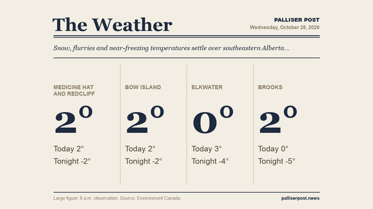
Southeastern Alberta is starting Wednesday under cloudy skies with mist, freezing fog and lingering flurries after overnight mixed precipitation, according to Environment Canada. Temperatures across the region are sitting just above zero and will remain there through the day, with periods of snow developing Wednesday evening and overnight lows dipping below minus 2.

Medicine Hat and Redcliff

At 6 a.m. at the Medicine Hat airport, it was 1.9 C with mist, a WNW wind at 13 km/h, humidity at 91 per cent and visibility of 8 km. Environment Canada expects rain mixed with snow to end early Wednesday morning, then cloudy skies with a 30 per cent chance of flurries or rain showers. Wednesday's temperature will hold steady near plus 2. The UV index is 1 or low. Wednesday night brings periods of snow beginning in the evening, a low of minus 2 and a wind chill of minus 6 overnight, with winds up to 15 km/h.

Bow Island

At 6 a.m. at the Bow Island Climate station, the temperature was 1.8 C with a WNW wind at 21 km/h and humidity at 94 per cent. Environment Canada calls for mixed rain and snow to end early Wednesday morning, followed by cloudy skies and a 30 per cent chance of flurries or rain showers through the day, with the temperature holding near plus 2 and a UV index of 1 or low. Snow returns Wednesday night, with periods of accumulation expected into the evening, a low of minus 2 and a wind chill of minus 6 overnight.

Elkwater and Cypress Hills

At 6 a.m. at Lodge Creek, the temperature was minus 0.1 C with a wind chill of minus 6, a WNW wind at 27 km/h and humidity at 100 per cent. Environment Canada forecasts periods of rain mixed with snow ending early Wednesday morning, then cloudy with a 30 per cent chance of flurries or rain showers and a high of plus 3, the warmest in the region Wednesday. The UV index is 1 or low. Wednesday night sees a 60 per cent chance of flurries late in the evening and overnight, with a low of minus 4 and a wind chill of minus 10.

Brooks

At 6 a.m. at Brooks, the temperature was 1.8 C with a NW wind at 16 km/h and humidity at 90 per cent. Environment Canada expects cloudy skies Wednesday with a 30 per cent chance of flurries and a north wind at 20 km/h, with temperatures falling to zero by the afternoon — cooler than most of the region Wednesday. The UV index is 1 or low. Wednesday night brings a higher chance of flurries at 60 per cent, with a north wind at 20 km/h becoming light by evening, a low of minus 5 and a wind chill of minus 8 overnight.

Outlook

Thursday will be mostly cloudy across the region with a 30 per cent chance of flurries in the morning, winds up to 15 km/h and highs ranging from plus 1 to plus 2, with wind chills near minus 10 or minus 11 in the morning in some areas; Thursday night lows will range from minus 5 in Elkwater to minus 10 in Brooks. Friday brings a mix of sun and cloud with highs of plus 2 to plus 3, and clear to partly cloudy Friday nights with lows from minus 4 to minus 7, according to Environment Canada.

Forecasts and observations from Environment Canada.

Share this article
The link has been copied!