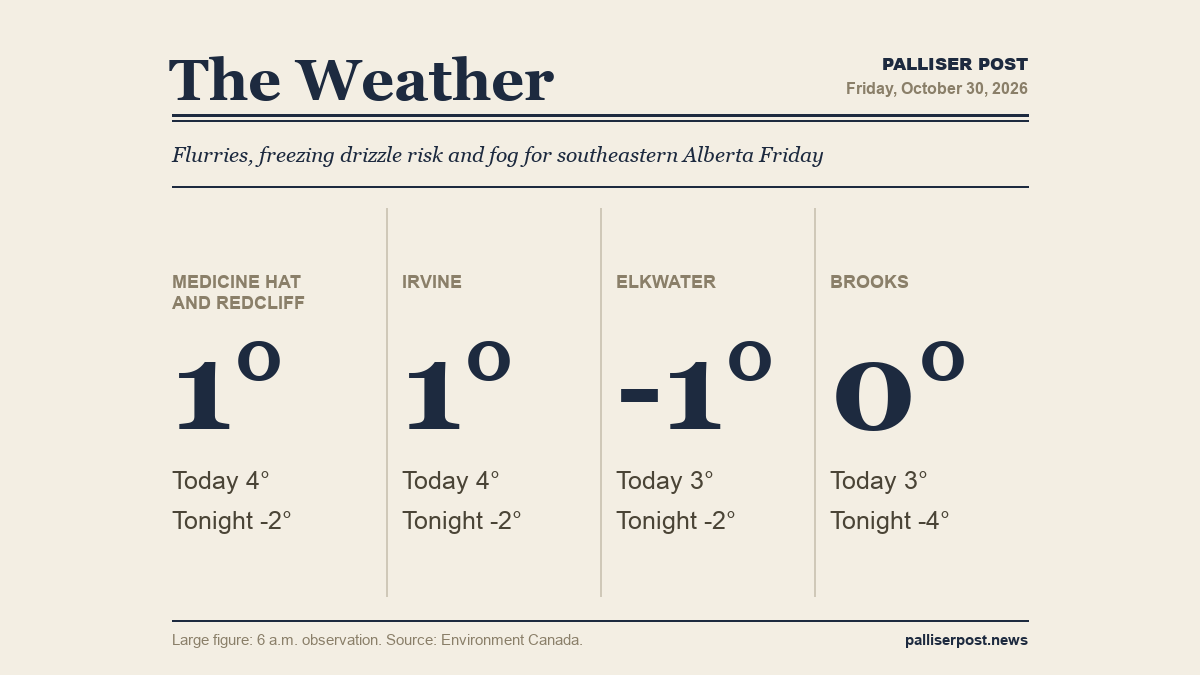
Cloudy skies, a chance of morning flurries and a risk of freezing drizzle will make for slippery conditions across southeastern Alberta on Friday, according to Environment Canada. Fog patches are expected to linger through late morning before dissipating. Highs will reach 3 to 4 C across the region, with overnight lows dipping below freezing and a risk of freezing rain returning after dark in some areas.

Medicine Hat and Redcliff

At 6 a.m. at the Medicine Hat airport, it was 0.9 C under cloudy skies with an east wind at 8 km/h and humidity at 85 per cent. Environment Canada calls for cloudy skies Friday with a 30 per cent chance of flurries this morning, a risk of freezing drizzle and fog patches dissipating late in the morning. Wind becomes east at 20 km/h near noon. High of plus 4. UV index 1 or low. Friday night brings a 30 per cent chance of drizzle in the evening, then a 30 per cent chance of rain overnight with a risk of freezing rain and fog patches developing near midnight. Wind east at 20 km/h becomes light in the evening. Low of minus 2, wind chill minus 6 overnight.

Irvine

At 6 a.m. in Irvine, the temperature was 0.7 C with an east-southeast wind at 13 km/h and humidity at 86 per cent. Environment Canada is calling for a cloudy Friday with a 30 per cent chance of flurries this morning, a risk of freezing drizzle and fog patches clearing late in the morning. Wind increases to east at 20 km/h near noon. High of plus 4. UV index 1 or low. Friday night sees a 30 per cent chance of drizzle in the evening and a 30 per cent chance of rain showers overnight, with a risk of freezing rain and fog patches forming near midnight. Wind east at 20 km/h eases to light in the evening. Low of minus 2, wind chill minus 6 overnight.

Elkwater and Cypress Hills

At 6 a.m. at Lodge Creek, it was minus 1.5 C with an east-southeast wind at 14 km/h, humidity at 94 per cent and a wind chill of minus 6. Environment Canada is forecasting cloudy skies for the Cypress Hills on Friday with a 60 per cent chance of flurries this morning — the highest precipitation chance in the region — along with a risk of freezing drizzle and fog patches lifting late in the morning. Wind becomes southeast at 20 km/h this morning. High of plus 3. UV index 1 or low. Friday night brings a 30 per cent chance of drizzle early in the evening, then a 30 per cent chance of rain showers late evening and overnight, with a risk of freezing rain and fog near midnight. Low of minus 2, wind chill minus 7 overnight.

Brooks

At 6 a.m. in Brooks, the temperature stood at 0.1 C with a southeast wind at 5 km/h and humidity at 81 per cent. Environment Canada is calling for cloudy skies Friday with a 30 per cent chance of flurries this morning and a risk of freezing drizzle, with fog patches expected to clear late in the morning. Wind shifts to south at 20 km/h near noon. High of plus 3. UV index 1 or low. Unlike most of the region, Brooks faces a mainly cloudy Friday night with no precipitation chance — though fog patches develop near midnight and a wind chill of minus 8 arrives overnight. Wind south at 20 km/h becomes light in the evening. Low of minus 4.

Outlook

Saturday brings a mix of sun and cloud across southeastern Alberta, with fog patches dissipating in the morning and highs of 7 to 8 C — winds up to 15 km/h and morning wind chills ranging from minus 6 to minus 8, according to Environment Canada. Saturday night turns partly cloudy with lows of minus 3 to minus 7. Sunday stays cloudy with highs of 4 to 8 C, and Sunday night brings periods of rain or freezing rain returning to much of the region, with lows of minus 3 to plus 1.

Forecasts and observations from Environment Canada.

Share this article
The link has been copied!